> ## Documentation Index
> Fetch the complete documentation index at: https://docsv4.mile.app/llms.txt
> Use this file to discover all available pages before exploring further.
# Map Icons and Routes
> What each icon, card and line on the Tracking map means: field workers, the hub, done and ongoing tasks, and the route colours.
The Tracking map uses a few icons and lines to show where your field workers are and how their day is going. Some appear all the time. Others appear only when a field worker is selected, when a task carries certain information, or when the field app has sent location updates.
Required permission:
* View tracking
## User icon
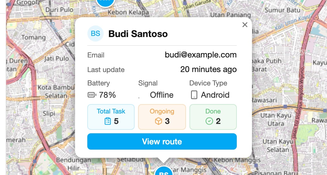
The user icon is a blue disc with the field worker's initials. It sits at the latest location their field app sent.
* With nobody selected, the map shows one user icon for every active field worker.
* When you select a field worker in the list, the map shows only their icon, together with their tasks and their trail.
Click a user icon to open its card:
* **Email**: the field worker's email address.
* **Last update**: how long ago the field app last sent this person's location. The field app sends locations while it is in use, so a long gap usually means the app was closed or had no signal.
* **Battery**: the phone's battery level at the last update.
* **Signal**: **Online** if the last update came in within the last 10 minutes, **Offline** otherwise.
* **Device Type**: the phone's system, for example Android.
* **Total Task**: all the field worker's tasks on that day, done and ongoing together.
* **Ongoing**: the tasks they still have to finish on that day.
* **Done**: the tasks they finished on that day.
* **View route**: select this field worker, the same as clicking their name in the list. Use it when the user list is hidden.
The **Filter** decides which time puts a task on the day (start time, created time or done time). See [Filter and History](/pages/monitoring/tracking/filter-and-history).
## Hub icon
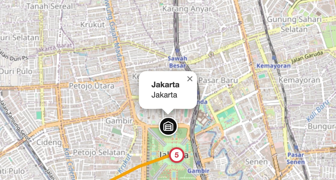
The hub icon is a black disc with a building. It marks the hub selected in the top bar. Click it to see the hub's name and address.
## Task icons
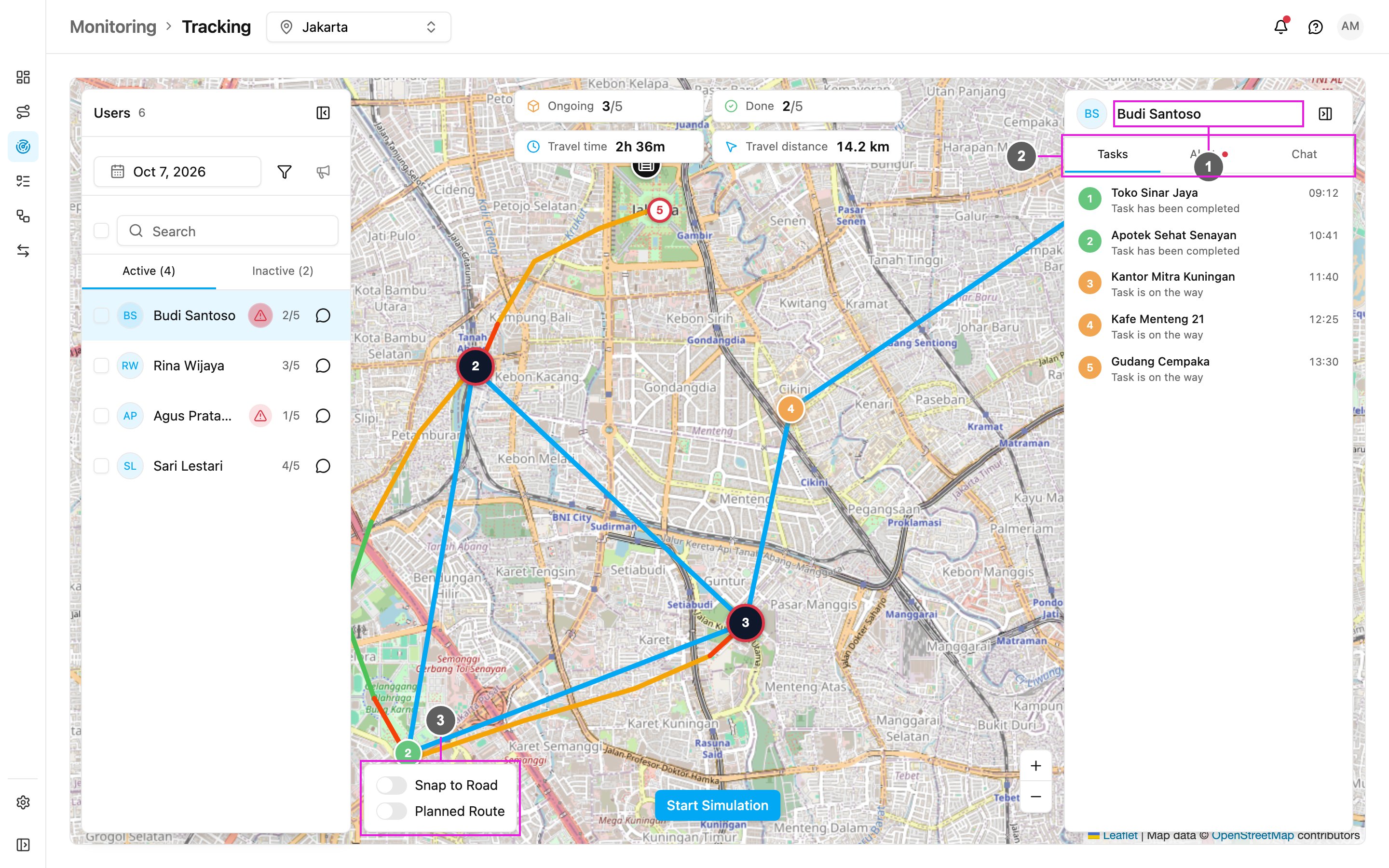
When you select a field worker, each of their tasks that has a location appears on the map as a numbered disc. The number is the task's place in the planned order (from [route optimization](/pages/planning/routing/introduction)), or its place in the day if the task was not planned. The colour shows the status:
* **Green**: done. The icon sits where the field worker finished the task.
* **Orange** with a soft ring: ongoing. The icon sits at the task's location.
* **Grey**: not assigned.
Tasks that sit close together are grouped into one disc showing how many tasks it holds. Zoom in to separate them. A group ringed in red contains an alert.
A task without a location is not on the map, but it is still in the field worker's task list.
### Done task card
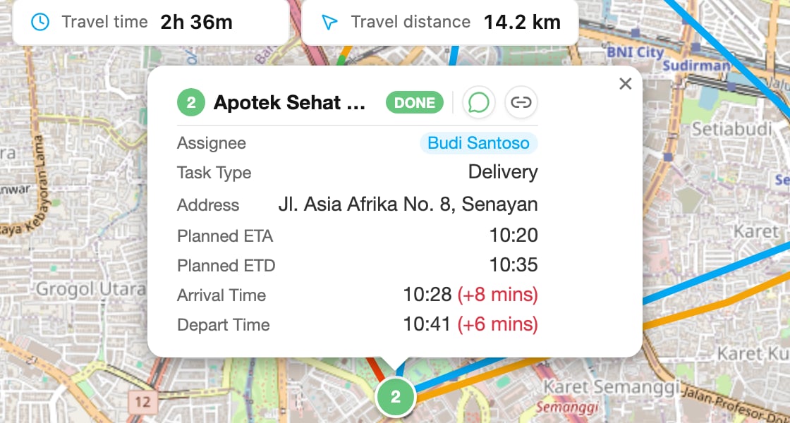
Click a green task icon to open its card:
* **Task title** with the order number and the **DONE** status. If the task has no title, the task type's name is shown.
* **Share by WhatsApp** and **Copy link** buttons: send the task's public tracking link by WhatsApp, or copy it. See [Public Tracking](/pages/activities/public-tracking/introduction).
* **Assignee**: the field worker who did the task.
* **Task Type**: the task type the task belongs to.
* **Address**: the field the task type marks as the address. Hidden when empty.
* **Label**: the task's labels. Hidden when empty.
* **Planned ETA** and **Planned ETD**: the arrival and departure times planned by route optimization. They only appear for tasks that were optimized and dispatched from [Routing](/pages/planning/routing/introduction).
* **Arrival Time**: when the field worker actually arrived, sent by the field app.
* **Depart Time**: when the field worker actually finished the task, sent by the field app.
If the field worker arrived or left later than planned, the time is shown in red with how late it was, for example **10:28 (+8 mins)**.
### Ongoing task card
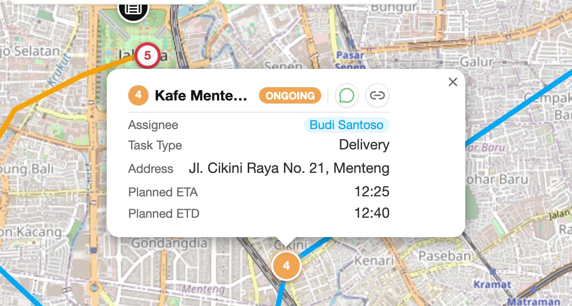
Click an orange task icon to open its card:
It shows the same details as the done task card: title and **ONGOING** status, the share buttons, **Assignee**, **Task Type**, **Address**, **Label**, and the **Planned ETA** and **Planned ETD** from route optimization. Arrival and depart times appear only once the task is done.
## Alert icons
When a field worker is selected and has alerts on that day, each alert is a numbered red ring on the map, placed where it happened. The number matches the alert's row in the **Alert** tab. Hover over it to see the alert type, for example *2. Idle: Detected*. See [User Details](/pages/monitoring/tracking/user-details#alert).
An emergency from the panic button is a red teardrop pin. See [Emergency Alerts](/pages/monitoring/tracking/emergency-alerts).
## Route lines
When you select a field worker, the map draws the route of their day.
### Actual route
The actual route follows the locations the field app sent, starting from the hub. Each stretch is coloured by the speed the field worker was going:
* **Red**: slow, under 5 km/h.
* **Yellow**: normal, 5 to 40 km/h.
* **Green**: fast, more than 40 km/h.
### Unfinished route
A blue line links the field worker's latest location to their remaining tasks, in order. It shows the trip still ahead of them.
### Snap to Road and Planned Route
Two switches at the bottom left of the map change how the route is drawn:
* **Snap to Road**: draw the actual route along the roads instead of straight lines between location points.
* **Planned Route**: show the route planned by route optimization as a thick dark blue line, from the hub through the tasks in planned order. Only tasks placed by a plan are on it.
## Related pages
* [Tracking](/pages/monitoring/tracking/introduction)
* [User Details](/pages/monitoring/tracking/user-details)
* [Filter and History](/pages/monitoring/tracking/filter-and-history)
This documentation is built and hosted on [Mintlify](https://mintlify.com), a developer documentation platform.